Visualization of Glacier Surface Movement
Summary
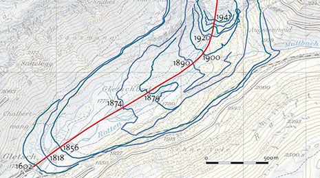
This interdisciplinary research project links the fields of cartography, GIS, and physical geography; it aims at visualizing monitored movement data of slow moving surfaces, e.g. ice sheets, glaciers, rock glaciers, or landslides. Such movement data encompass surface velocities, i.e. speed and direction, changes in thickness and surface, as well as changes in the outline of the phenomena. The data is derived from remote sensing analysis of repeatedly acquired satellite images.
Project period
28.01.2010 – 14.10.2016
Researchers
Lead: Hurni, Lorenz
Internal: Wiesmann, Samuel
Funding sources
Own Resources of the Professorship
Partners
- Swiss Federal Institute for Forest, Snow and Landscape Research (WSL)
- University of Applied Sciences and Arts, Northwestern Switzerland (FHNW)
- Laboratory of Hydraulics, Hydrology and Glaciology (VAW), ETH Zurich