Terrain Analysis
Hinweis: Die folgenden Informationen sind in Englisch verfasst.
Summary
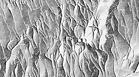
This project brings together cartography and computer graphics to develop new visualisation methods drawing on design expertise of cartography, and algorithmic and mathematical know-how of computer graphics. New digital methods for cartographic terrain visualisation in 2D and 3D will be developed. In the sub-project "Terrain sketching" automatic methods for producing cartographic terrain depictions like shaded relief and rock hachures from raster elevation models are being developed, including the generalization of the elevation data.
Kick off
01.07.2010 – 29.05.2019
Researchers
Lead: Hurni, Lorenz
Internal: Geisthövel, Roman. Veronesi, Fabio.
Funding source
Swiss National Science Foundation (SNSF)
Partner
O.Saurer and M.Pollefeys, Department of Computer Science, ETH Zurich